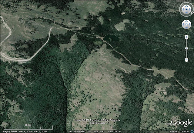
Yesterday I posted in both the ongoing situation at Attabad (and I am glad to say that it now seems likely that the reported landslide at Shimshal was a false alarm) and the mud and debris flow at Oliver in Canada. It is now reported that the Oliver slide was caused by the failure of an embankment retaining a small irrigation lake. If that is the case then I assume that the lake is this one:
The damage, shown below in an image from the Vancouver Sun, does serve to demonstrate the destructive potential of lake collapses, and thus our ongoing concerns about Attabad:
Has anyone seen any decent images of the path that the flow took between the lake and the valley floor?


Interesting to see that someone said something to someone about the lake and dam prior to the mudslide:
ReplyDeletehttp://www.cbc.ca/canada/british-columbia/story/2010/06/16/bc-oliver-mudslide-investigation.html
Andrew