Whilst we wait for news from Pakistan, here are two new resources that readers may find useful. First, NASA have released a new Aster image of the lake site, collected in the last few days. This is available
here, with a link to my blog (thanks to them for this). The image shows the manner in which the lake has extended in the last few weeks - NASA have helpfully provided an image with the previous extents shown:
The unannotated image, this time orientated north-south, is also rather fine:
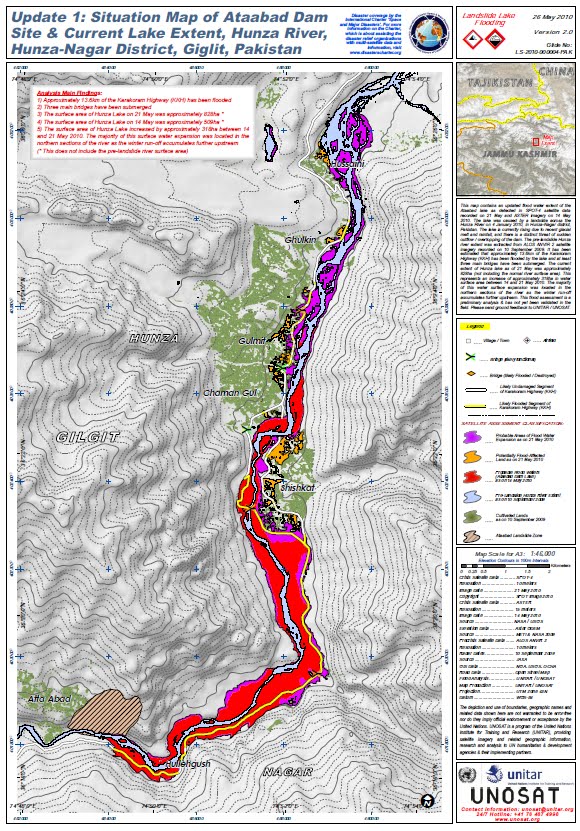
Alonside this, UNOSAT have released another map of the areas inundated by the flood. This is available
here, and looks like this:
We may see some landslides along the banks of the lake as the water level is drawn down by the breach, so this imagery may prove to be very useful.


Thanks for this Dr Dave, it's very interesting. It's kind of surreal that the best source on a landslide in Pakistan is a UK blog.
ReplyDelete