Tuesday, March 30, 2010

Can toads detect forthcoming earthquakes (and landslides?)

The mainstream media is reporting a story this morning that breeding toads in Italy apparently relocated from their nests five days before last year's L'aquilla earthquake in Italy. This is picking up on a paper published in the Journal of Zoology today by a team from the Open University.

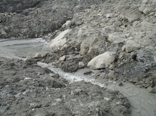
The paper examines toad numbers at San Ruffino lake, 74 km from the earthquake focus:


The authors observed that on 28th March, 90 male toads (Bufo Bufo) had gathered for the breeding season . However, on 1st April, five days before the event, 96% of the male toads disappeared. This disappearance is reported to coincide with a burst of very low frequency radio wave disturbance of the ionophere, detected by a Russian receiver network. Numbers did not return to near normal levels until 15th April, reportedly two days after the last M>4.5 aftershock.

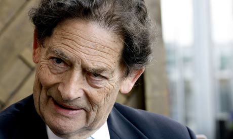
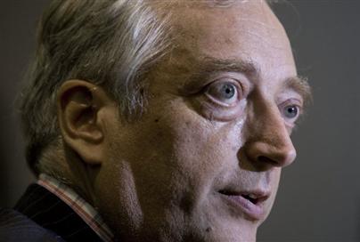
A Bufo Bufo toad. Similarities in appearance to climate change deniers Nigel Lawson and Christopher Monckton are apparently entirely coincidental. Image from here

There are three things that intrigue me about this report:
  1. Why would toads develop an evolutionary ability to detect earthquake precursors (the Independent article speculates on this below, so I will return to it)? On the whole sitting in a pond of water is probably not a bad place to be in an earthquake, even one with mudslides, especially in a location like this lake, which is not obviously landslide-prone.
  2. The Independent article makes the following statement, quoting Rachel Grant, the Journal author: "Russian scientists suggested that the toads may have been able to detect the release of radioactive radon gas from the ground, or the presence of charged particles in the ionosphere of the night sky, Dr Grant said. If so, it may be an evolved ability to protect the slow-moving animals from the frequent mud slides caused by earthquakes, she added." Hmmmm! For this to be effective the toads would need to know where to go should a mudslide be likely. I am not sure where this would be or how a toad would know.
  3. The toads were located 74 km from the focus of what was a small earthquake. Can toads really detect precursors from this distance, and again why would there be an evolutionary advantage in being able to so-do, given the low probability of a landslide at such a large distance?
None of this undermines the observed behaviour or indeed the observational science of the paper. However, once again the focus is upon the potential for prediction of earthquakes, which is frankly a sideshow, when the real need is to focus on preparedness.

Is a lavafall a landslide?

The Mountain Cat Geology blog has an astonishing image of a lavafall in Iceland following the recent eruption (click on the image for a better view in a new window):

I wonder whether this is technically a landslide, given that it is a mass movement consisting entirely of rock?

Thursday, March 25, 2010

Attabad - the mainstream media has finally woken up to this story

Within the mainstream media the Attabad landslide story has been on slow burn for a while now, with a bit of interest last week. However, Reuters have run a story on this today that should now see it gaining a higher profile over the next few days:

Reuters Story (Key parts only):
Authorities in northern Pakistan are struggling to prevent the bursting of a natural dam formed by a landslide that could affect more than 50,000 people and sever an important trade link with China. The landslide, in early January, killed 14 people and blocked the Hunza River, creating a huge lake that inundated several villages and left about 25,000 people stranded. Residents says the government has not done enough to get supplies and contain the threat of a breach.

(SNIP)

Officials are scrambling to ease pressure on the dam by creating a spillway, and say they do not see any immediate threat of a breach. But residents say the situation is extremely precarious. The water level is rising every day, adding to the pressure which could lead to a breach in the lake," Hussain said.

(SNIP)

A senior official at the NDMA, that was formed after a October 2005 earthquake that killed 73,000 people in the country's northwest, said all precautionary measures had been taken to prevent any human loss. "Possibilities of an outburst exist, but the chances are very remote and we are prepared for the worst," said Col. Amir Siddique. Work is under way to remove debris and create a spillway, due for completion by mid-April, that would provide a channel into the riverbed for a controlled outflow of lake water. But an official involved in the rehabilitation efforts, who declined to be identified, said there would still be a danger of flash floods, as the chance of a breach exists until the pressure on the blockage is reduced."In the worst case scenario, if the lake bursts the water will damage or destroy all bridges in the area and will damage the KKH," the official said. He said the wave, which could be as high as 50 metres at its start, would affect nearly 11,000 people in districts of Gilgit-Biltastan and another 40,000 to 50,000 people downstream.

Not a bad write up, but my own view is that the quote that "Possibilities of an outburst exist, but the chances are very remote and we are prepared for the worst" is not quite my reading of the current situation, certainly in terms of the likelihood of an outburst event. I am not sure what the current state of preparation is, but if the quote is correct then the governemnt has done a great deal of work since I left three weeks ago.

Update of the Attabad water level and seepage situation

I have this morning updated the post on the Attabad water level and seepage situation. The post is here. Seepage appears to have now stabilised at about 0.4 cubic metres per second, whilst the water level is rising at about 35 cm per day.

Meanwhile, the Pamir Times has published this image of the seepage:

Monday, March 22, 2010

The Haiti tsunami

The State of the Planet blog, which is the blog of the Earth Institute at Columbia University, reports on an ongoing investigation of the tsunami that killed a small number of people to the west of Port-au-Prince (image below from the National Geographic).

The research has involved drilling cores into the sediment on the sea floor near to the tsunami. Their initial analysis suggests that the tsunami was caused by a lateral spread near to the coastline, which released a flow down the offshore slope into deeper water. It is this submarine landslide that was probably responsible for the localised tsunami.

They promise more analysis in the coming days, so watch this space.

Attabad landslide report

The report that I wrote about the Attabad landslide as a result of my recent visit to the site is now available. You should be able to download it here:

http://www.mediafire.com/file/lymztmnwnzd/10_02 Hunza landslide short report final.pdf

Sunday, March 21, 2010

Attabad landslide: latest update on the lake level, seepage rate and spillway height

The latest data on the Attabad landslide is available here. I have added a graph of reported seepage rate against time.

A new submarine landslide at NW Rota, near Guam

The NW Rota volcano is located in the Mariana Volcanic Arc, about 100 km north of Guam at a depth of about 520 below sea level. NSF currently funds an scientific expedition to this active volcano; a scientific cruise to this site is currently occurring. The team are running a blog of their experiences and findings - it is here.

Yesterday they reported that in the time since their 2009 cruise the volcano has experienced a major landslide. The bathymetry data shows this rather well:

The landslide has caused up to 100 m of erosion from the summit area of the volcano (the blue areas on the map) and up to 40 m of deposition on the gentle lower slopes. These deposits extend for a distance of 8 km.

Saturday, March 20, 2010

The water level and seepage at the Attabad landslide - graphs of the current situation

Latest update: 25th March 2010 08:00 GMT

I thought it would be useful to post a graph of the current state of play with the water and spillway levels, as I understand it. The water level is from the NDMA daily(ish) updates; the spillway height comes from the freeboard measurement from FOCUS. Needless to say I have no way to validate this data.

Graph as of 23rd March 2010 (the last day for which I have data):


The graph starts on 1st February as this is when the NDMA data starts. Be very careful deriving a date upon which the lake will reach the spillway from this data as the spillway height is somewhat nebulous (can anyone give a definitive height?), it is of course being lowered, the rate of filling may change as snowmelt arrives, etc.

The graph of reported seepage rate is as follows:

Thursday, March 11, 2010

The landslide at Attabad has developed seepage

Late last week the landslide at Attabad started to develop some seepage. Over the last few days this has gradually increased in rate and is now measured at about 9.4 cubic feet per second (0.25 cubic metres per second). The Pamir Times has some images of the seepage:

Given this volume of water it is likely that this is flow through the dam, although at the moment this remains unconfirmed. If so, this is a source of real concern as landslide dams sometimes fail through piping. Fortunately, both Focus and NDMA are monitoring this, but there is now a real urgency about getting an evacuation plan in place. This situation could now develop much more rapidly than we had anticipated a week ago.

Manchester talk on the Sichuan Earthquake disaster

Yesterday I gave a talk to the Manchester branches of the Geographical Association and the Geological Association on the causes of the Sichuan (Wenchuan) earthquake disaster. As usual I promised to make my slides available via Authorstream. You should be able to download the presentation as well as viewing it below.:

Wednesday, March 10, 2010

Attabad landslide - the Pakistan Government response


Yesterday a meeting was held by the Ministry of the Environment in Islamabad to discuss the Attabad landslide, based at least in part on my report from my recent field visit on behalf of Focus. I am glad to say that the upshot of that meeting is that the authorities are now preparing an evacuation plan for a potential breach of the lake, according to this report:

"As over 15,000 persons are at high risk due to blockade of Hunza river due to an avalanche, Minister for Environment Hamidullah Jan Afridi Tuesday directed authorities to prepare an emergency plan to rescue people prior to releasing the water. At an important meeting held to review the situation after accumulation of water in the Hunza river, the minister asked FWO, NESPAK, NDMA and other authorities to conduct an immediate study of the impact if lake bursts out, and prepare a foolproof plan. “Let us come up with a time-frame and estimated volume of damages if the lake outbursts and also gauge the magnitude of relief we needed thereon,” he asked the participants of the meeting, belonging to key departments like NDMA, NESPAK, SUPARCO, WAP-DA, Ministries of Environment and Interior and the Gilgit-Baltistan government. “Lives of the people are important for us. We need a comprehensive study and plan for expected damages and rescue efforts,” Afridi said, adding that he would seek support from the Chinese government to release water from the Hunza river. The Hunza river was blocked after a two-kilometre wide and 380 feet high avalanche slipped into it at Ata Abad on January 4. Due to this avalanche, the water was blocked and created a 213 feet deep and 11.5 kilometre long lake. The experts briefed the minister that the outburst of this lake would damage vast area and also threaten lives of more than 15,000 people from Hunza down to Gilgit and onwards to NWFP upto Tarbela dam. Ms Khadija from SCOPE in her presentation mentioned that more than 500,000 people would suffer, to minor and major magnitude, if the water is not released and the lake bursts out spontaneously. She also mentioned of the impact downstream Gilgit upto Tarbela and proposed to gradually release the water from the lake ensuring minimum damages. It is worth mentioning that a spontaneous outburst will not only displace thousands of residents but also have a reverse flow impact on Gilgit, Gizer and Skardu rivers like the 1858 floods that had reversed the flow of Kabul river upto 50 kilometres. It will further be aggravating the damages exposing the localities besides these rivers to hazards as well as damaging around 30 kilometre patch of Korakorum Highway. The water level in the lake had risen to 213 feet by Tuesday and was rising by two feet daily. The situation will become more dangerous with increased inflow after melting of snow as temperature usually rises upto four degree centigrade in April."

It is good to see that the government is responding to the threat posed by this landslide dam.

Tuesday, March 9, 2010

Free workshop on coastal erosion, 19th March 2010

We are running a free workshop on erosion on 19th March 2010 in North Yorkshire, UK. Details in the flyer below, together with contact details (click on the image for a better view in a new window).

Please do register to come along!


Monday, March 8, 2010

Another life lost at Attabad

Construction of the spillway at Attabad in northern Pakistan continues, but there is little doubt that the construction workers at the site, and indeed those walking over the dam to access the boat service, face considerable risks from rockfalls from the original landslide scar. On 4th March such a rockfall occurred, striking two people on the upslope face of the landslide deposit. One, an army bulldozer driver, was injured whilst the other, a boyscout named Shezad, was unfortunately killed.

The rockfall that caused the incident was captured on video and can be seen below. The event in question starts at about 2 minutes 25 seconds. The final part of the video shows the aftermath of the rockfall as the two victims are brought up to a vehicle to be taken to hospital. Shezad is placed inside the cab, whilst the army worker is placed on the back of the pick-up. By western standards the coverage might be considered to be intrusive:


Meanwhile, the Pakistan government appears to be growing increasingly aware of the very serious threat posed by the landslide. The President of Pakistan, Asif Ali Zardari, yesterday expressed concern about the situation in terms of the provision of relief and on the construction of the spillway. However, the biggest issue is still the potential flood associated with breaching of the dam. The apparent lack of concern about this is very worrying.

The lake level continues to rise at about 50 cm per day according to the NDMA figures.

Friday, March 5, 2010

New rockslide video: Highway 96 at Klamath River near the Siskiyou-Humboldt county line

Thanks to Kyle House of the Nevada Bureau of Mines and Geology for bringing this one to my attention.

A great new video was posted yesterday showing a rockslide onto Highway 96 at Klamath River near the Siskiyou-Humboldt county line in California. The video should be embedded below:

Rock slide on Hwy 96 in Northern California near the Humboldt/Siskiyou County line. from Paul Hailey on Vimeo.


Well worth a look! More details of the slide here:

http://www.redding.com/news/2010/mar/03/staggering-rock-slide-closes-highway-96-near-humbo/

The Attabad landslide in N. Pakistan - some initial images from my field visit this week

I am now back from my comparatively short but very interesting trip to the Attabad landslide in N. Pakistan. I will make a series of posts about this serious but very interesting landslide over the next few days. As a taster, here a few images of the site. The first image was taken from the top of the 1858 Salmanabad landslide deposit, looking upstream to the Attabad slide. The scar of the landslide is on the left and extends beyond the snowline. The main landslide deposit is on the right, coated with a layer of black clay-silt sediment that was scooped up from the river bed by the slide. In the valley bottom the secondary flow is also visible - this was a mudflow of riverbed sediment that travelled about 1.5 km. Look carefully on the full image (click on the image below to see this) and you will see the ruins of some buildings on the left side of the mudflow, at the junction with the rock cliff. This is the place where the 19 victims of the landslide died, struck by the mudflow:

The image below shows the spillway under construction. At the moment the spillway is still being excavated in the black mudflow deposit, although this will shortly break through to the underlying colluvium. The army are optimistic that the spillway will survive the summer flood - others may have a different opinion...

This final image is a view from the top of the landslide deposit looking upstream. In the foreground is the landslide deposit - note the lack of black clay here. In the background is the lake and, beyond that, the rock walls of the main river valley. If the landslide does survive then a new section of the Karakoram Highway will need to be built through this section. This will take some time.

More to follow.

Wednesday, March 3, 2010

Landslides in Art Part 5

I apologise for the lack of posts of late. I am currently in Pakistan to visit the Attabad landslide, courtesy of FOCUS Pakistan. I will post on that soon, and of course there has been a great deal happening in the landslide world whilst I have been in the field.

Anyway, this is the latest in my series on landslides in art. The previous parts can be found here:
Part 1
Part 2
Part 3
Part 4 (coastal erosion)

This edition of courtesy of the ever-helpful Sekhar Kuriakose of ITC in the Netherlands.

The artist in E.J Roychan, an artist from Kerala in India, now living in Saudi Arabia. The piece is called "Urul Pottal", which means debris flow, in Malayalam. Sekhar describes the genesis of the piece as follows:

"He is a very good friend of mine. He got inspired by my work on landslides and contemplated and created this piece for me."