This is a nice illustration that the physical rules that control landslides are the same the world over (or that journalists play games occasionally...). Below is the well-known USGS image of the 1995 La Conchita landslide in California:
Compare the above image with this Telegraph Calcutta picture of a landslide at St Antony’s Colony in Munnar, India.
Many readers will be familiar with the La Conchita landslide in California. For those who aren't, La Conchita a small (population about 340 people), unincorporated seaside village located on the Pacific coast north of Los Angeles (Fig. 1) (34.4 degrees north, 119.5 degrees west). The town is located on a narrow coastal plain, with a steep slope behind. The houses are very close to the foot of the slope (Fig 2).
Fig 1: Google Earth image showing the location of La Conchita
Fig 2: Oblique Google Earth image showing the town of La Conchita with the steep slope behind. Note the very clear landslide scars
The town shot into the limelight on 4th March 1995 when a landslide slipped off the slope and buried or damaged seven houses. Fortunately no-one was killed, but it clearly caused considerable concern. The landslide is the subject of perhaps one of the most famous of all landslide pictures, taken by the USGS (Fig. 3). The landslide was large (120 m wide, 330 m long, and >30 m deep, with an estimated volume of 1.3 million cubic metres. However, the slide occurred as a coherent earthflow and was comparatively slow.
Fig 3: USGS image of the 1995 La Conchita landslide
Unsurprisingly, in the aftermath of the landslide concerns were raised about the safety of the town. In particular, it is clear from Figure 2 that the slope is mantled with old landslide scars and deposits. There was consistency in the views of the experts that further landslides on the slope were likely. Sadly, this proved to be correct because on 10th January 2005, during a period of very heavy rainfall, a further landslide occurred. On this occasion a portion of the failed mass from 1995 remobilised and hit the upper part of the town.
Fig 4: USGS image of the 2005 La Conchita landslide
Amazingly, the failure of the upper part of the landslide was caught by a TV crew (see here or below).
 Compare the above image with this Telegraph Calcutta picture of a landslide at St Antony’s Colony in Munnar, India.
 Almost a mirror image! Hmmm.......!
 Fig 1: Google Earth image showing the location of La Conchita
 Fig 2: Oblique Google Earth image showing the town of La Conchita with the steep slope behind. Note the very clear landslide scars
 Fig 3: USGS image of the 1995 La Conchita landslide
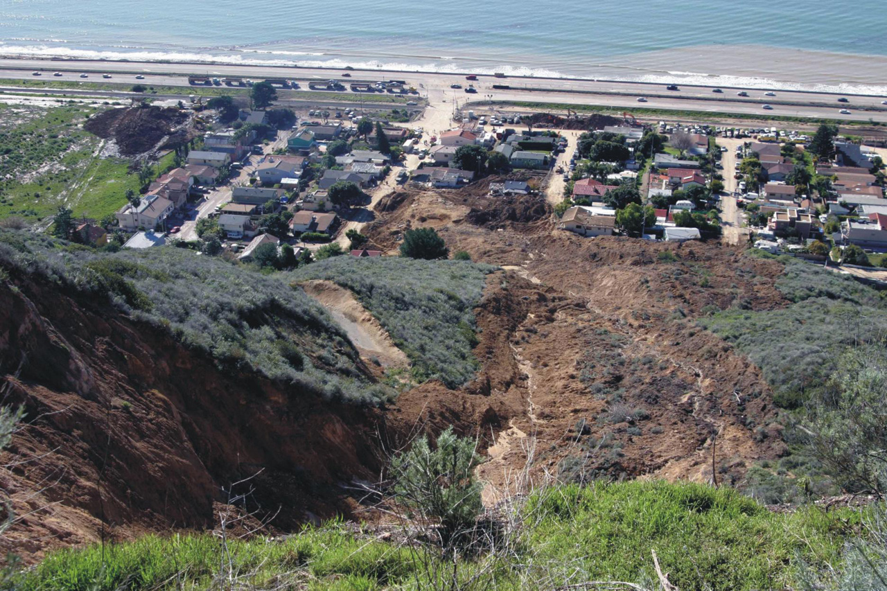 Fig 4: USGS image of the 2005 La Conchita landslide