IRIN, the UN Office for the Coordination of Human Affairs, has produced a rather nice video about the impact of lahars (a landslide in comparatively young volcanic materials) in the Philippines. The landslide occurred during Typhoon Durian (known in the Philippines as typhoon Reming) in 2006.
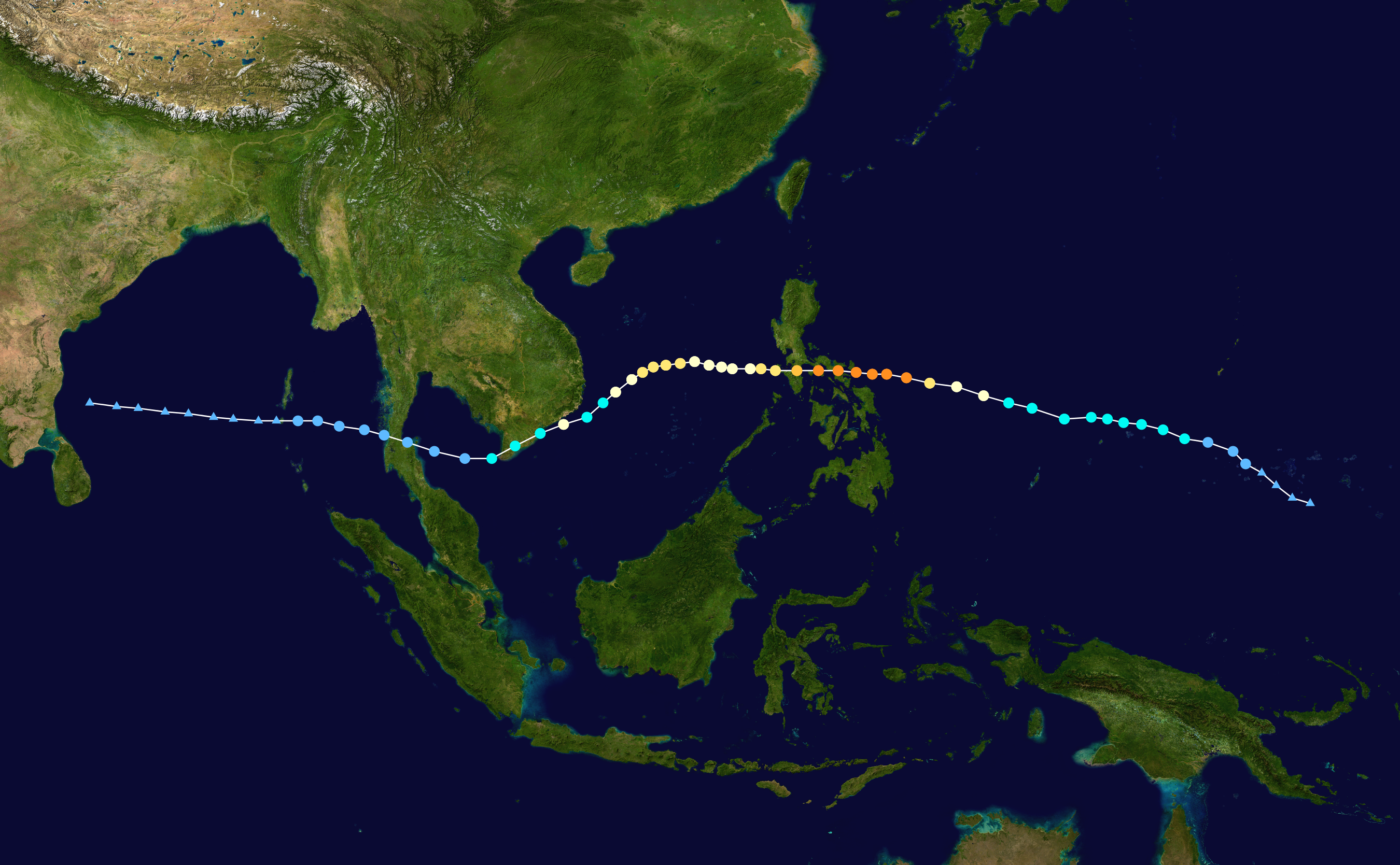
 Wikipedia image of the track of typhoon Durian (Reming) in 2006. The orange dots indicate the locations at which the typhoon was at its maximum intensity
 NASA image, derived from TRMM data, of the rainfall associated with typhoon Durian (Reming). Note that although 200 mm is very high, far greater rainfall totals are often associated with large typhoons.
Lahars surged down the flanks of Mount Mayon, killing over a thousand people. The film focuses on a comparatively affluent family whose house and land was hit by the lahar. The children's mother was killed, their house destroyed and their land inundated. In the aftermath the government declared the flanks of the volcano to be too hazardous, meaning that the family were moved into a refugee camp. The father of the family is relentlessly cheerful (except when he revisits his house and sees his wife's pillow), but his desperation is clear to see.
The film is available
here.
 Google Earth image of Mount Mayon, showing a lahar deposit. Click on the image for a full size view in a new window.
In many ways the most interesting aspect is the way that the film balances the hazards associated with the natural processes (i.e. the danger of another event) with the hazards associated with displaced people moving to new settlements that can quickly become slums. It is an interesting film that brings home some fundamental issues in a very real way, without presenting anything terribly new. It is certainly useful for teaching both in schools and at undergraduate level, and as a reminder to those of us working on hazards as to the complexity of the impact of decisions.
 UNOSAT image of the impact of Typhoon Reming on Mount Mayon, showing in particular the multiple lahar tracks. Note the degree to which the lahars have impacted upon the towns.